Friday, August 24, 2007
GDAL2Tiles - Summer of Code - EPSG:4326
Being involved in the Open Source world as it applies to Geospatial is interesting.
Google does almost every year, a Summer of Code, and OSGeo was involved in this as well. More information can be found on the Wiki about this years projects.
Tiling and speed have always been issues with Internet Mapping - especially with Raster Images.
Just recently Klokan Petr Pridal described his Summer of Code project as being able "to allow easy publishing of raster maps on the Internet. Your raster file (like TIFF/GeoTIFF, MrSID, ECW, JPEG2000, JPEG, PNG) is converted into a directory structure of small tiles (TMS compatible), which you can just copy to the webserver. Simple webpages with viewers based on Google Maps and OpenLayers are generated as well - so anybody can comfortably explore your maps on-line and you do not need to install or configure any special software (like mapserver) and the map displays very fast in the webbrowser. "
Through Open Source we are seeing innovation in the way software is being developed and the speed of take-up and understanding by developers worldwide. Tools, such as the one's developed by Klokan will soon be on internet maps worldwide, using libraries that have being developed by Frank Warmerdam (FWTools, GDAL) to make mapping easier.
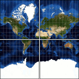
Of course, there are always co-ordinate system problems involved and some restrictions. Currently the software (if using Google) is restricted to EPSG:4326 (Good ol'WGS84!). There is one line that scares us Surveyors - "World files and embeded georeference is used during tile generation, but you can publish a picture without proper georeference too".
No Georeference means - where are we? Be careful out there. Co-ordinates are always important in any mapping application. It is always important to know your:
1) Datum
2) Map Projection
3) Ellipsoid
as a very bare minimum. Depending on the Map Projection used, then you always have to consider the False Easting, False Northing, Central Meridians, Latitudes, etc..
As the technology increases and becomes faster and easier, we can tend to make mistakes easily and make too many assumptions about the data. Not all data is EPSG:4326. Remember, maps are only as good as the people who produce and understand them. When you have people reading and relying on your maps, especially when pulling data (for eg. via WFS), there may be different co-ordinate systems - hence roads may move, lakes may be on cities, etc., etc..
As the blog posting several days back pointed out, boundaries are important and the idea of Redrawing the Map was discussed. We'll see what happens in resolving this political dispute, but again the accuracy of the data and the maps produced will be important.
Now, for an excellent example of GDAL2Tiles - Summer of Code, take a look at the beautiful country of the Czech Republic and see some tiling and speed that can put some commercial software to shame.
An example of tiling using Open Layers is the city of Moscow.
See if you can find the Kremlin and Red Square.
Keep on watching this space and I'll bring more news about Open Source for GeoSpatial and someday soon will be producing some samples using Oil and Gas, Mining and Forestry Data.
It is a whole new world out there and geomatics is changing rapidly.
Monday, August 20, 2007
FOSS4G2007 - Victoria, BC
FOSS4G2007 is happening soon in the current location I've planted some roots - Victoria, B.C., Canada.
Who knows whether these roots will be permanent or not. It seems I move every two years, whether in North America or overseas. The world seems so small with Air Travel nowadays.
The opening and closing plenary speakers have all be selected and they have accepted. The keynote speakers :
Geoff Zeiss, Director of Technology, Autodesk
Tyler Mitchell, Executive Director, OSGeo
Peter Rushforth, Technology Advisor, GeoConnections
There is also a series of Lightening Talks, consisting of eight speakers, with five minutes each, that will try to being as concise an overview of open source geospatial software, community building, open geodata projects, and many demonstrations. Demonstrations always seem to grab the attention of the listeners. A picture is worth a 1000 words!
Damian Conway, will be opening the conference, with his observations of open source culture in Geek Eye for the Straight Guy.
The closing plenary will include a panel discussion featuring:
Peter Batty, Independent Consultant
Tim Bowden, Director, Mapforge Geospatial
Mark Sondheim, BC Integrated Land Management Bureau
Frank Warmerdam, President, OSGeo
And of course, I'll be presenting there, about map projections, datum's, and co-ordinate systems and how to make your way around them using Open Source Geospatial Software.
I'll be instructing this lab with Frank Warmerdam (the creator of GDAL, PROJ.4, and many other Open Source libraries).
L-03: Datums, Coordinate Systems, Map Projections & Datum Transformations
Location. Location. Location. With so many maps and datums out there, how does a person know what datum is correct? How come my GPS coordinates don't match up on my map? Why is there a shift of 100 metres? How do I transform between different datums? What is a datum? What is the EPSG? Why have GIS Vendors and Oracle adopted them? Does offshore or onshore make a difference? How come there are so many datums? This presentation looks to provide some answers to some of these questions and to point out that latitude and longitude are not absolute.
Over the decades that surveyors have been trying to map the Earth, history and politics have shaped the way we see the world. Are the borders actually there? What if one nation adopts a standard, but the other does not? Does really matter what the co-ordinate system is? Why when I draw the a UTM Projection, the lines are curved, not in a grid? Is the OGC adopting these standards? So many questions and this presentation aims to answer some of them and provide some light on a complicated and sometimes unclear topic.
Hope to see everyone there. It looks to be a great conference!
Sunday, August 12, 2007
FOSS4G2008 Awarded to Cape Town and Hartebeesthoek94
It was during this period, that I met a distinguished professor at the University of Cape Town, Charles Merry. The problem I was sent there to resolve was how to transform the co-ordinates of well, seismic lines, leases, etc. from the Cape Datum to Hartebeesthoek94 Datum (which is based on WGS84). Charles Merry and his colleagues were working on this grid transformation (of which the methodology was based on the Canadian National Transformation V2).
Prior to January 1, 1999, the co-ordinate reference system used in South Africa as the foundation was the Cape Datum. This Datum (similar in the way it was developed to NAD27, which is based on an origin point of Meades Ranch, Kansas and the Clarke 1866 ellipsoid) was referenced to the Modified Clarke 1880 ellipsoid and had its origin point at Buffelsfontein, near Port Elizabeth. The Cape Datum was derived by the work of HM Astronomers, Sir Thomas Maclear, (1833 - 1870), and Sir David Gill, (1879 - 1907). Their initial geodetic objectives were to verify the size and shape of the Earth in the Southern Hemisphere, from which later work would provide geodetic control for topographic maps and navigation charts.
The new datum, has its named derived from the initial point at the Hartebeesthoek Radio Astronomy telescope, near Pretoria. In many ways, South Africa took the lead in establishing that WGS84/Hartebeesthoek94 became a standard.
I look at my work in the U.S. and realize, that even though the technology of GPS was developed in the U.S., most of the mapping as it relates to oil and gas, mining, forestry is still storing their data in NAD27 (though it may be acquired in WGS84 - especially offshore deepwater GOM - Gulf of Mexico).
Companies will not change (using the argument of cost - being related to labour and software), unless they are made to. In the case of South Africa, the South African government realized that they can not be lazy. If companies want to work and explore in South Africa (especially if most the reserves are offshore), they will be using GPS or other satellite methods of locating wells and acquiring data. Therefore it makes sense to use a global co-ordinate system such as WGS84.
My experience has been, where a company can make a significant profit or has a significant stake, they will meet the requirements necessary to work in those countries - but often the leadership for this change has to come from government and not from industry. In the case of South Africa, it took the lead. Because of this lead, it is well respected within the Surveying and Mapping community and shows that we in North America can follow the lead if we have elect the leaders that actually have the will-power to legislate the changes. Many of the Canadian provinces have and it is now becoming mandatory. Hopefully many of the States will follow. Maps and co-ordinates are important in our everyday life and if we have better ways of defining locations, we should use them and expect them to be used. In many ways Google has helped this and may actually help companies and nations move forward to accepting WGS84 as a standard. In the end, the cost of maintaining data in old datums will be more expensive than actually implementing the change now.
Through people, such as Charles Merry, and the involvement and awarding of FOSS4G2008 to Cape Town, we can see South Africa is moving ahead swiftly and contributing to software development and is taking steps to be a leader in its corner of the world.