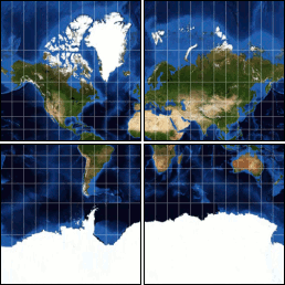
Being involved in the Open Source world as it applies to Geospatial is interesting.
Google does almost every year, a Summer of Code, and OSGeo was involved in this as well. More information can be found on the Wiki about this years projects.
Tiling and speed have always been issues with Internet Mapping - especially with Raster Images.
Just recently Klokan Petr Pridal described his Summer of Code project as being able "to allow easy publishing of raster maps on the Internet. Your raster file (like TIFF/GeoTIFF, MrSID, ECW, JPEG2000, JPEG, PNG) is converted into a directory structure of small tiles (TMS compatible), which you can just copy to the webserver. Simple webpages with viewers based on Google Maps and OpenLayers are generated as well - so anybody can comfortably explore your maps on-line and you do not need to install or configure any special software (like mapserver) and the map displays very fast in the webbrowser. "
Through Open Source we are seeing innovation in the way software is being developed and the speed of take-up and understanding by developers worldwide. Tools, such as the one's developed by Klokan will soon be on internet maps worldwide, using libraries that have being developed by Frank Warmerdam (FWTools, GDAL) to make mapping easier.
Of course, there are always co-ordinate system problems involved and some restrictions. Currently the software (if using Google) is restricted to EPSG:4326 (Good ol'WGS84!). There is one line that scares us Surveyors - "World files and embeded georeference is used during tile generation, but you can publish a picture without proper georeference too".
No Georeference means - where are we? Be careful out there. Co-ordinates are always important in any mapping application. It is always important to know your:
1) Datum
2) Map Projection
3) Ellipsoid
as a very bare minimum. Depending on the Map Projection used, then you always have to consider the False Easting, False Northing, Central Meridians, Latitudes, etc..
As the technology increases and becomes faster and easier, we can tend to make mistakes easily and make too many assumptions about the data. Not all data is EPSG:4326. Remember, maps are only as good as the people who produce and understand them. When you have people reading and relying on your maps, especially when pulling data (for eg. via WFS), there may be different co-ordinate systems - hence roads may move, lakes may be on cities, etc., etc..
As the blog posting several days back pointed out, boundaries are important and the idea of Redrawing the Map was discussed. We'll see what happens in resolving this political dispute, but again the accuracy of the data and the maps produced will be important.
Now, for an excellent example of GDAL2Tiles - Summer of Code, take a look at the beautiful country of the Czech Republic and see some tiling and speed that can put some commercial software to shame.
An example of tiling using Open Layers is the city of Moscow.
See if you can find the Kremlin and Red Square.
Keep on watching this space and I'll bring more news about Open Source for GeoSpatial and someday soon will be producing some samples using Oil and Gas, Mining and Forestry Data.
It is a whole new world out there and geomatics is changing rapidly.
